

Looking for an adventure on Hawai’i’s Big Island? Look no further! Take a hike to the summit of Mauna Loa, the world’s largest volcano! Found in the Hawai’i Volcanoes National Park, Mauna Loa is a must-see for all Hawaii visitors. There are two main ways to go about hiking the Mauna Loa Summit Trail: starting at the Mauna Loa Lookout (off Mauna Loa Road) or starting at the Mauna Loa Observatory Road. This post covers the first option.
Although this spot is technically part of Hawai’i Volcanoes National Park, it doesn’t require an admission fee because the road to get to the trailhead doesn’t take you through the park entrance gate. Very convenient for those without park passes. The trailhead for the Mauna Loa Trail starts at the Mauna Loa Lookout, which requires an 11.5-mile drive up the mountain on Mauna Load Road.
This isn’t the typical mountain road you might be imagining. It’s not bordered on one side by a steep dropoff or anything like that, but it is a rough road. It is a two-lane road for most of the drive, but it does get down to a narrow one-lane road for the last few miles. That’s where it gets rough. You don’t need a 4-wheel-drive, but it will probably be helpful if you have that option. There are large potholes that will require some navigation, but nothing your rental car can’t handle. Budget about 35-45 minutes depending on your comfortability and weather conditions.
Once you finally make it to the end of the road, you’ll see the lookout hut to your right, parking on the left. There aren’t a lot of spots (only 5 or 6) so get there early to beat any potential crowds. There is a bathroom at the lookout, but I didn’t recall seeing a water bottle filling station, so do that before you hit the road. The trailhead begins right between the parking spots and the lookout hut. This is an out and back trail, so you can adjust your hike based on time and skill level.
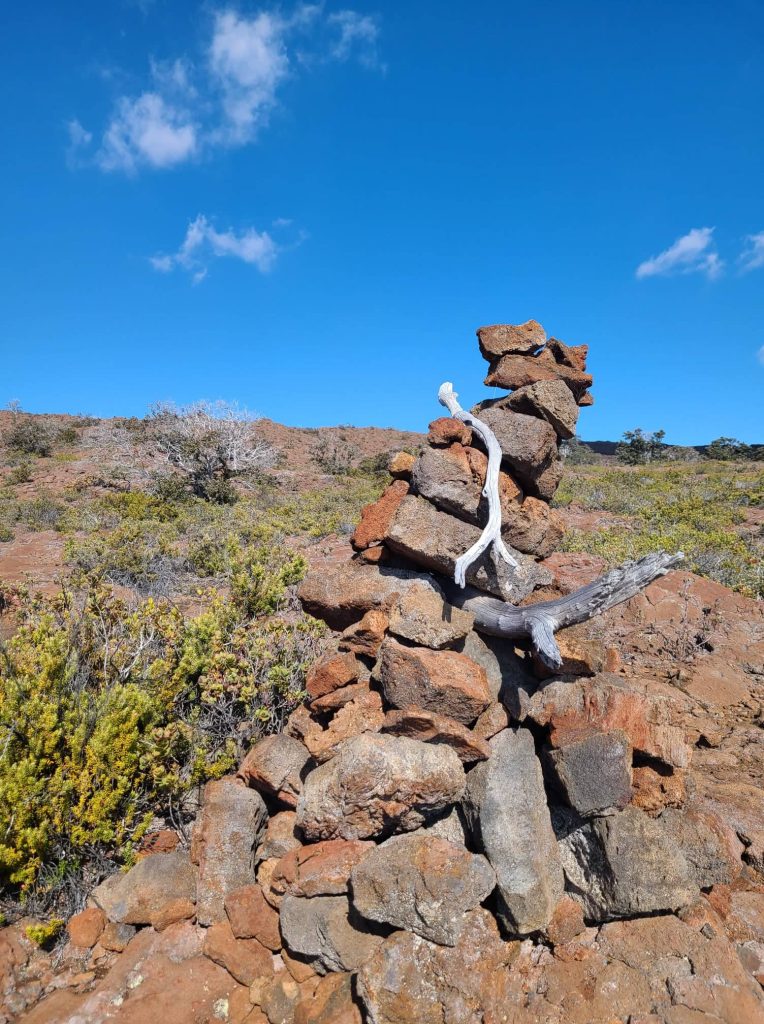
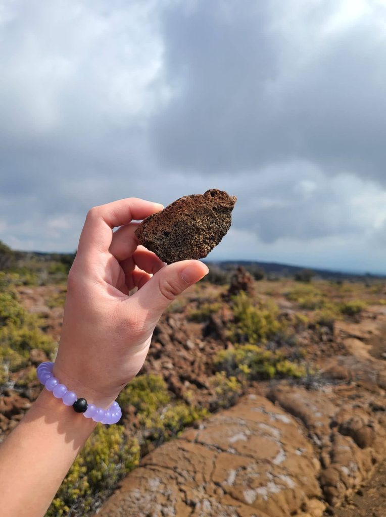
The trail starts in a fairly dense forest space before quickly giving way to the rocky lava terrain. When you come across a big metal gate, don’t turn around! The gate isn’t locked and it’s not meant to keep hikers out. It’s actually there to prevent goats from getting in, so make sure you close it behind you. The trail is marked with ahu, rock piles, to designate the proper path. These can be difficult to spot, so I’d recommend not passing one until you’ve locked the next one in. We often found ourselves distracted in conversation, suddenly wandering along the mountainside without an ahu in sight. We only saw one person on our way up, and a handful on the way down, so it’s not a heavily trafficked trail, but that means it’s not well-worn, so best to keep your eyes peeled and watch where you’re going so you don’t get lost.
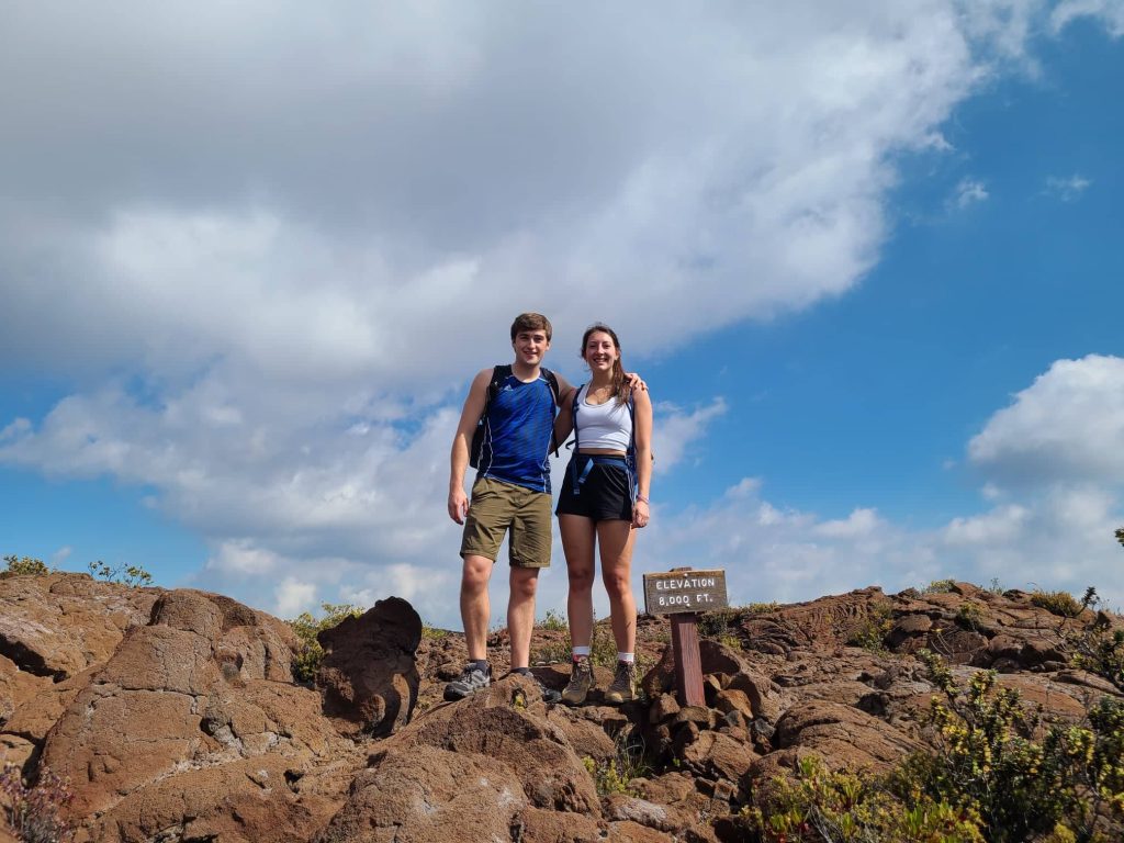
We hiked 3 miles up the trail, so just a bit past the 8,000ft elevation marker for a 6-mile roundtrip. It was right around this point that the vegetation was becoming very thin and almost entirely rocky. We walked just a few hundred more yards past the 8,000ft marker to try and get a glimpse of the snowcapped summit of Mauna Loa, and we were blessed with a very distant view of the peak. We were lucky that it was a pretty mild day for Hawai’i, so the heat wasn’t overbearing and we had no issues with rain or weather. However, it is constant elevation gain, so it can get exhausting on the way up if you don’t have enough water or food in your system. I was guilty of both which made the hike much more draining, so come prepared.
The full Mauna Loa Summit Trail is about 19.5 miles long one way with a 7000ft elevation gain. There are a couple stopping points along the trail including cabins to stay in such as the Puʻuʻulaʻula Cabin and Summit Cabin, so make use of them if you’re planning to hike all the way to the summit. We also passed by a hiker who had pitched a tent along the trail, so that’s an option as well. If you are looking for a challenge, the full hike has been done in a single day, and you can read about it here. I wouldn’t recommend trying this unless you are experienced and know what you’re doing.
Overall, this is a great hike if you’re interested in a challenge and seeing some really cool rocks. But if your goal is beautiful views, you’d better plan on hiking a lot further than we did. The beginning of this hike is beautiful, don’t get me wrong, but the jaw-dropping views are going to require a few more miles and a lot more time, so know what you want before you go.
I hope this post was helpful in planning your next hiking adventure to Mauna Loa on Hawai’i’s Big Island! Safe travels for those hiking the Mauna Loa Summit Trail, and hike on!

One thought on “Hiking the Mauna Loa Summit Trail”